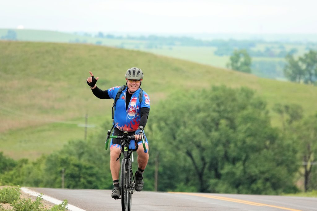
All routes are tentative and subject to change depending on road conditions, construction, etc. Stay tuned to our Facebook page and website for any additional changes to the routes.
Saturday
Click on the links in the titles to see the full Ride with GPS routes with file downloads.
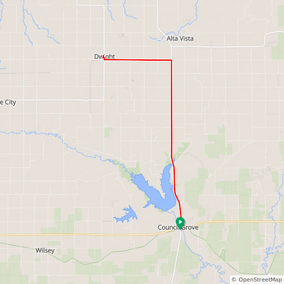
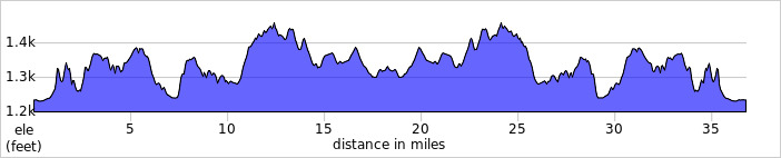
Route 1 – Road Short – Click Here for Full Route
Total Miles: 36
Elevation: +1237/-1237 ft
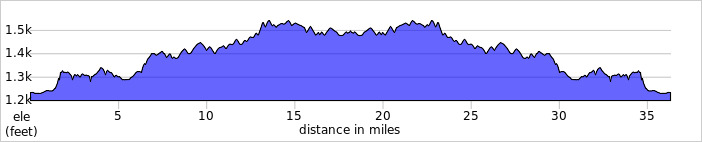
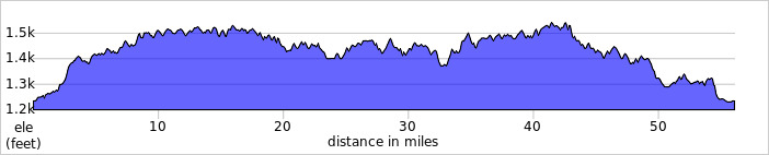
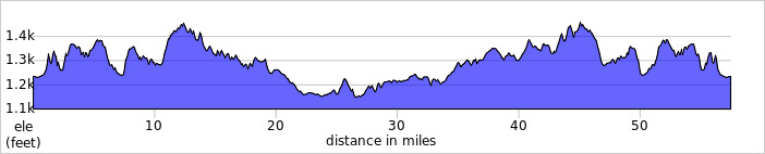
Route 2 – Road Medium – Click Here for Full Route
Total Paved Miles: 56
Elevation: +1806/-1806 ft
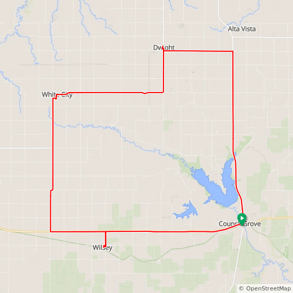
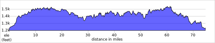
Route 3 – Road Long – Click Here for Full Route
Total Paved Miles: 75
Elevation: +2351/-2250 ft
Notes on Saturday Road Routes
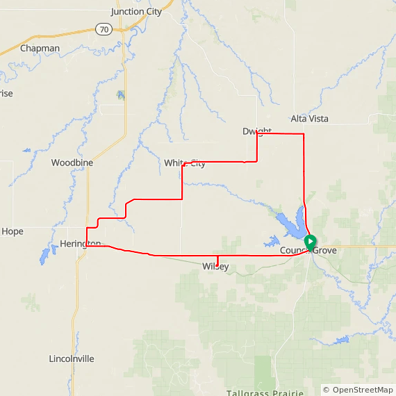
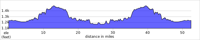
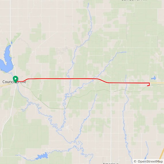
Saturday offers a choice of three routes with distance choices of approximately 36, 56, and 75 miles exploring the countryside to the west and north of Council Grove. While not flat, these routes are not too challenging in regards to elevation changes. Communities along these routes include Wilsey, Herington, White City, and Dwight.
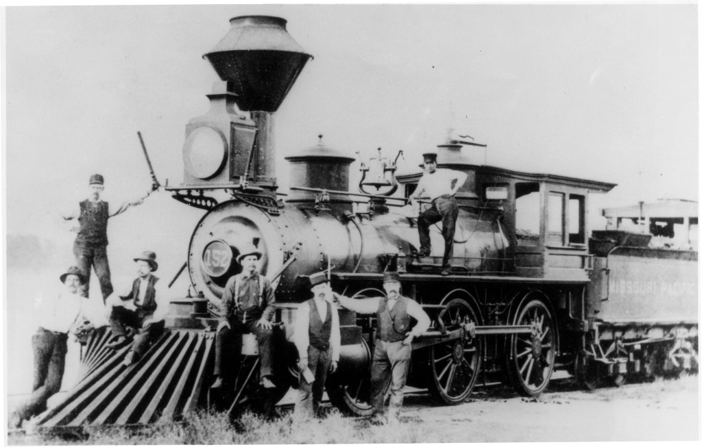
The ride might be described as a journey through former rail towns as Herington, White City, and Dwight were all stops along the former Chicago, Kansas, and Nebraska Railway. In 1887, the Chicago, Kansas, and Nebraska Railway built a main line from Topeka to Herington. This line connected KVBC’s home town of Topeka with Valencia, Willard, Maple Hill, Vera, Paxico, McFarland, Alma, Volland, Alta Vista, Dwight, White City, Latimer, and Herington. Note that Council Grove was a rail town as well but that line was owned by the Missouri Pacific Railroad.
Herington has an interesting history which can be found here: Herington History. For more modern history, a look at the area maps will reveal the Herington Regional Airport (east of town), formerly the Herington Army Air Field which during WWII was “one of only two fields that processed heavy bombardment crews and equipment staging to the coasts for overseas duty.” These bombers included B-17s, B-24S, and B-29s: Airport History
White City history can be found here: White City History. It is another small rural town formed along the Missouri-Kansas-Texas Railroad and later the Chicago, Kansas, and Nebraska Railway.
Dwight resides at the intersection of K-4 and K-57 & was established in 1887. History can be found here: Dwight History 1 & Dwight History 2.
The 56-mile and 75-mile route options head west on Highway 56 initially. The first SAG is in Wilsey and shared with the gravel route option. It is worth noting that the still incomplete portion of the Flint Hills Nature Trail parallels Highway 56 between Delevan and Herington.
The 36-mile option is an out-and-back ride to Dwight. For those wanting an easy start to the weekend or who may arrive a bit later Saturday morning, this may be the perfect option. It could easily be complemented by a shorter ride in the afternoon.
Sunday
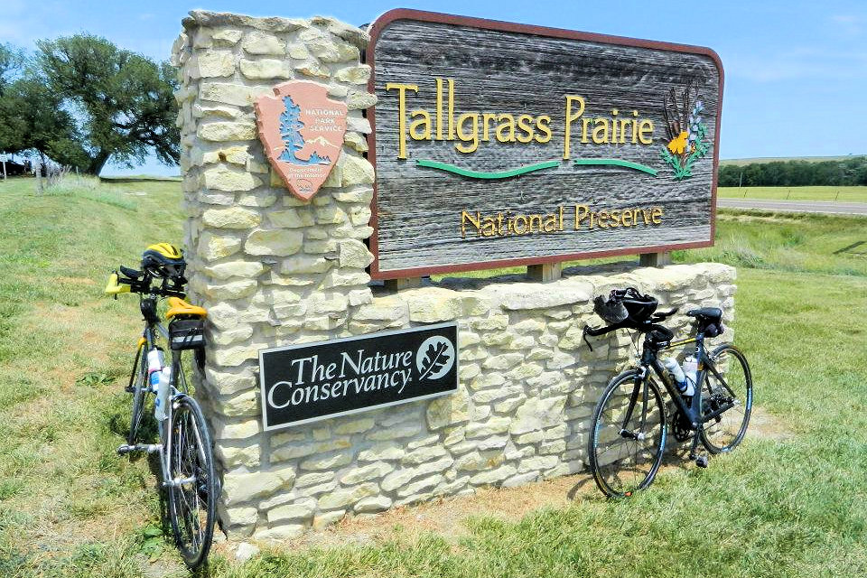
This route passes by the Tallgrass Prairie National Preserve. A catered brunch will be served in Strong City for all riders.
Route 1 – Road (All) – Click Here for Full Route
Total Miles: 52
Elevation: +1448/-1448 ft
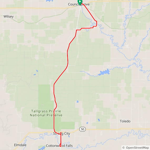
Notes on Sunday Road Route
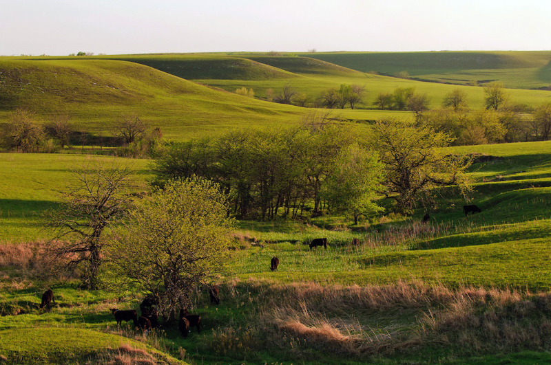
Sunday’s ride is the cornerstone of the Cottonwood 200 and offers one of the most scenic rides in Kansas. The 52-mile ride takes place on a portion of the Flint Hills National Scenic Byway on K-177 between Council Grove and Cottonwood Falls. Despite following the same route each year, it is never the same ride 2 years in a row. You will face steady climbs, joyful downhills, and broad views of this unique landscape. Be prepared for wind, heat, cool, sun and/or mist. Your southbound efforts will be rewarded scenic sights in Cottonwood Falls and by a tasty meal in Strong City before you return to Council Grove.
For more information on the Flint Hills National Scenic Byway click here:
Flint Hills National Scenic Byway, Flint Hills Highways and Byways, and also Scenic Drives in the Flint Hills for a potential afternoon drive through the Flint Hills.
K-177 takes you past Tallgrass Prairie National Preserve which was established by Congress in 1996 and designated as National Historic Landmark in 1997. We highly recommend you make time to stop at the Preserve either during your ride or later. Check the National Park Service website for their hours. It is a nice place for a short hike if you want a little more activity.
For more information check out these links:
Tallgrass Prairie National Preserve
Plan Your Visit
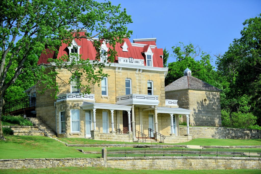
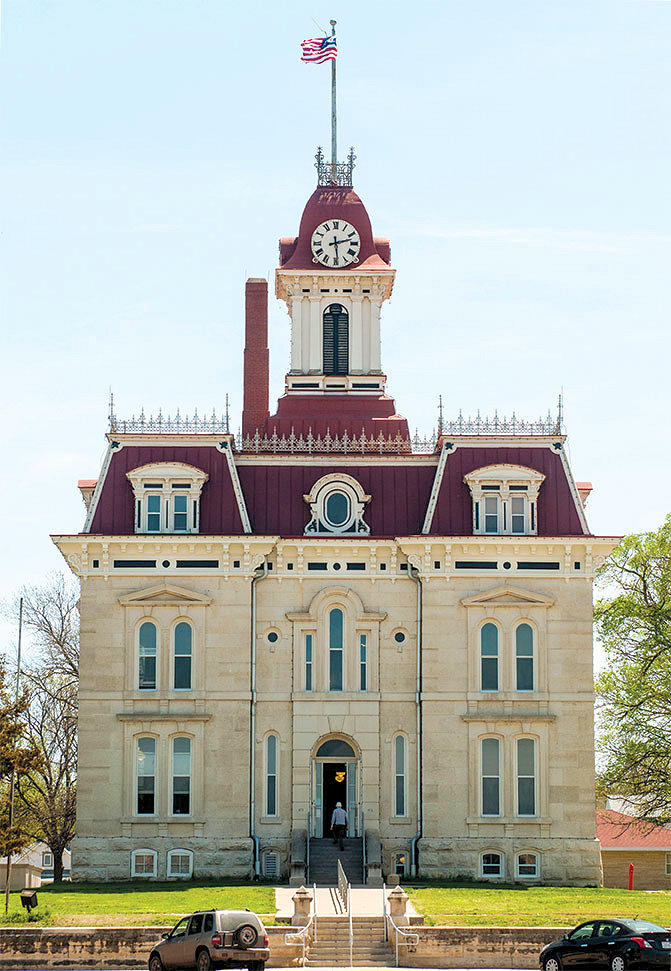
Cottonwood Falls is known for its Chase County Courthouse and falls. For info on the history of Cottonwood Falls click here: Cottonwood Falls History
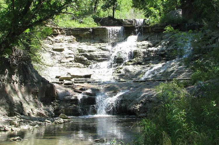
There are falls at the north end of down town at the Cottonwood River Bridge and also the Chase County Falls located a couple miles west of K-177 on Lake Rd at Chase State Fishing Lake: Chase Lake Falls.
There is the likely possibility that by Memorial Day weekend KDOT will close a 3-mile section of Hwy 177 from the south side of Council Grove to 4 Mile Rd. for bridge construction. From that point on to Strong City/Cottonwood Falls, Hwy 177 will be open with little traffic. Assuming this 3-mile closure is the case, the route to Strong City/Cottonwood Falls will work as follows:
As per the route posted for Sunday, riders will follow paved Dunlap Rd. southeast from Council Grove to the turn at 4 Mile Rd. which will connect back to Hwy 177 past the construction. This section on 4 Mile Rd. will be 3.5 miles on gravel. This is a well-maintained road and is usually hard packed enough for road bikes to travel on. Those riders not wanting to take this section will be provided transportation across the gravel by Cottonwood 200 staff at specified times for both the morning ride out and the afternoon return from Cottonwood Falls.
We apologize for the inconvenience but since this is the 50th Anniversary of the Cottonwood 200 it would be a shame to miss out on the beautiful ride through the Flint Hills to Cottonwood Falls and back to Council Grove, which is the hallmark of this ride event.
As we firm up plans to accommodate riders not wishing to take the gravel section, we appreciate your understanding that we cannot control what the highway department does or when. More information about plans to traverse 4 Mile Rd. will be made available as we get closer to the event. If you have further questions, please contact kvbctopeka@yahoo.com.
Monday
There will be a catered lunch after the ride back at Council Grove High School.
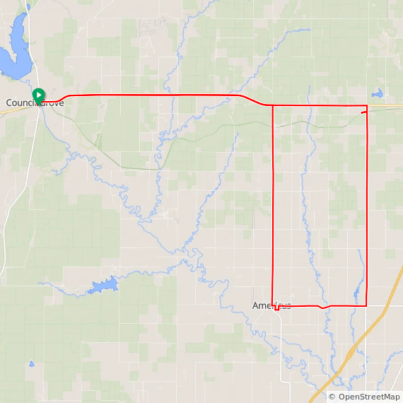
Route 1 – Road Short – Click Here for Full Route
Total Miles: 36
Elevation: +1665/-1665 ft
Route 2 – Road Long – Click Here for Full Route
Total Miles: 57
Elevation: +2284/-2284
Notes on Monday Road Routes
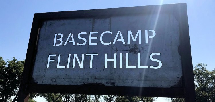
Monday’s 36 and 57 mile routes lead you east of Council Grove to the cities of Allen and Americus and continue to explore the rolling hills of Kansas. We are once again using Basecamp Flint Hills as our primary SAG stop. We encourage you to check out their little oasis along the Flint Hills Nature Trail in Allen, Kansas. Thanks to Darius & Amy for hosting us again.
Allen was originally established along the Santa Fe Trail in 1854. Later, in order to gain railroad access, the town moved southwest 3 miles to its current location along the former Missouri Pacific Railroad line and was granted a depot. More history can be found here: Allen History.
Americus was established in 1857 shortly after the Kansas Territory was opened in 1854. Americus participated in the purchase of bonds that were used to help encourage the Missouri, Kansas, and Texas Railroad to come to the area. The railroad was also known as the MKT and K-T or Katy Line. Riders might recognize this name from the Katy Trail Rail Trail located in Missouri. This info and more history can be found here.
